CiFR-Lancaster
Flood mitigation effectiveness of NFM interventions within the Cumbria Innovative Flood Resilience project
1 Nov 2021 to 31 Mar 2027
(Update 2025-27: technician monitoring/QA contract full-time to 17 Dec 2026; PI 12 days in 2025 and 10 days in 2026 for management, plus 5 days in 2025
and 16 days in 2026 for 3 LU research papers, and 3 days Jan-Mar 2027 for CiFR-Lancaster report prep)
This Lancaster-led research project is Workstream 3 (WS3) of the Cumbria Innovative Flood Resilience project (CiFR). CiFR is a £6.5M project within the £200M EA/Defra Flood and Coastal Resilience Innovation programme (FCRIP). This programme is about delivering NFM (Natural Flood Management) and SuDs (Sustainable Drainage systems) schemes at larger scales than previosuly attempted, in part, by utilising innovative approaches and technology. It is, therefore, a 'Research-by-Doing' programme. The primary objective of CiFR-Lancaster is to quantify the effectivess of NFM temporary storage features to be installed upstream of selected communities at risk of flooding. The effectiveness assessment primarily focuses on the benefits of reducing flood peaks, but also the co-benefit that NFM interventions may have for mitigating water pollution. CiFR is currently focusing on the following communities-at-risk of flooding (but may be able to add interventions and associated effectiveness monitoring at further communities in Cumbria):
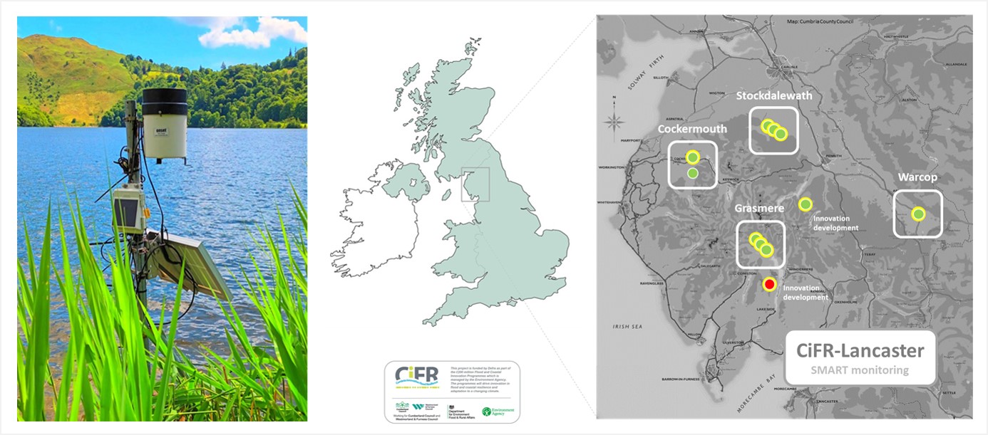
The Grasmere lake rainfall, level and temperature station (left) and CiFR-Lancaster network in Cumbria, UK (right).
via MetronVIEW) no public interface
(live nitrate data by microfluidics via Metasphere) no public interface
(live nitrate and turbidity data by UV-Vis via Grafana) no public interface
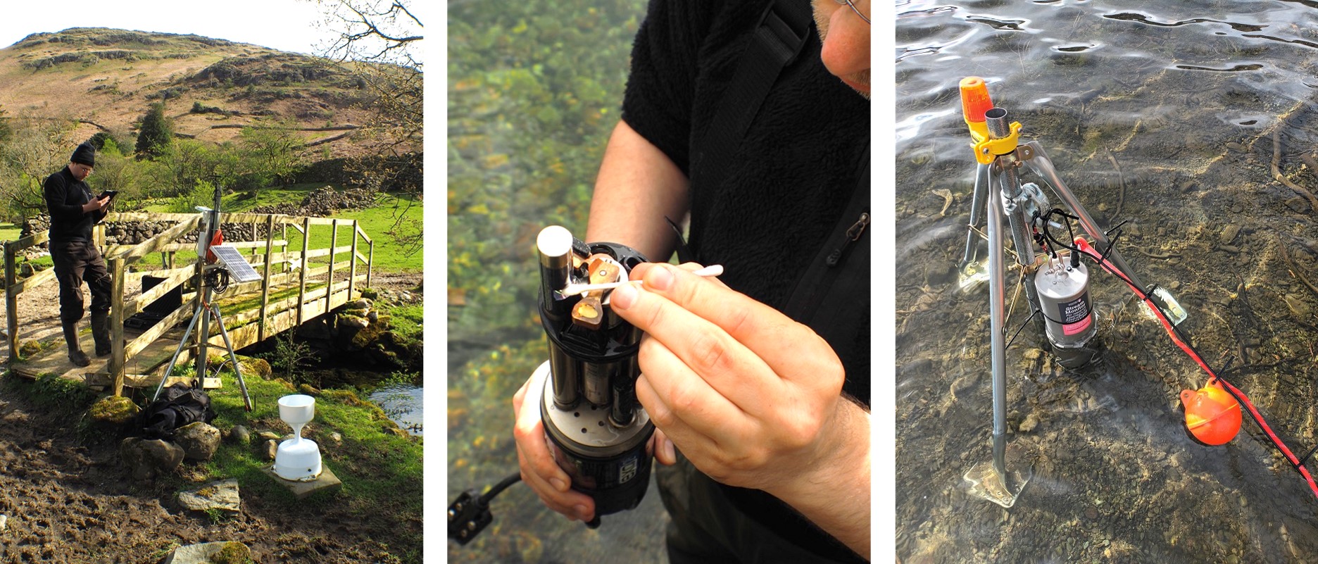
The LU Far Easdale baseline stream level monitoring station (left), servicing of LU Rothay water quality sonde (centre) at EA Grasmere level station, and LU micro-fluidics nitrate probe at Grasmere lake-edge (right).
(for live public access to level graphs for flood alerts
contact n.chappell@lancaster.ac.uk for password)
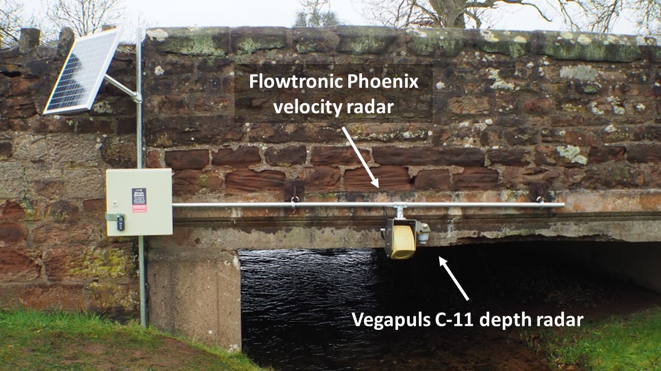
(offline rainfall via Kalyx-RG)
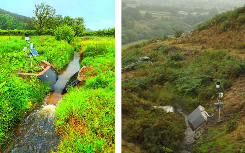
LU Bitter Beck raingauge and discharge flume (left) and LU Sware Gill raingauge and flume, adjacent headwater to Tom Rudd Beck (right).
via MetronVIEW) no public interface
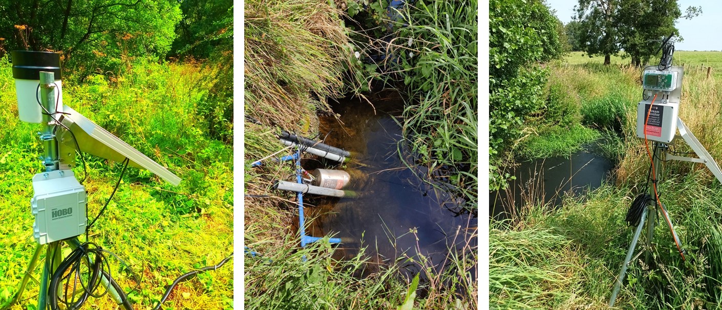
The LU Upper Roe stream level monitoring station (left), LU Upper Ive water quality station with phosphate sonde and turbidity system (centre), and LU Upper Ive level monitoring station (right).
(live discharge and level data via Fathom Scientific AutoSalt) no public interface
(live phosphate data by microfluidics via Metasphere) no public interface
(live nitrate data by microfluidics via Metasphere) no public interface
(live nitrate and turbidity data by UV-Vis via Grafana) no public interface
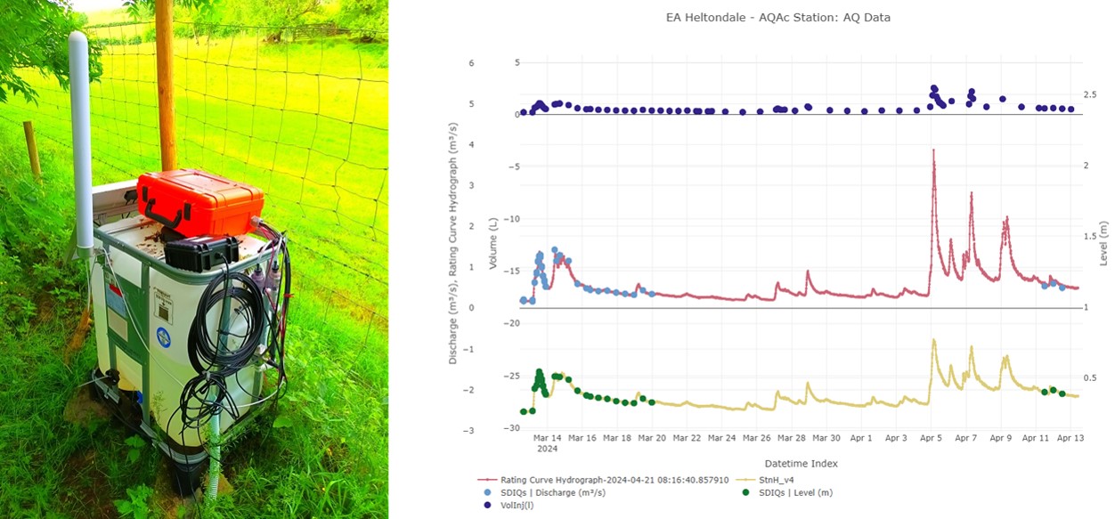
For example, an LU continuous dilution gauging unit (left: 'Fathom Auotsalt') and example NaCl gauging times for EA Heltondale gauging station (right)
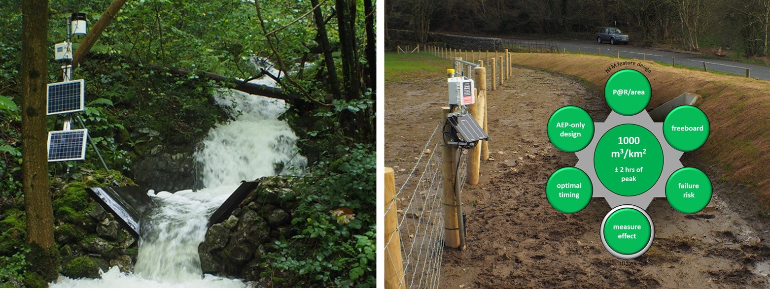
The LU Eggerslack net rainfall and discharge flume (left), and LU level monitoring station at the Grange floodplain bund (right) - see Chappell and Beven (2024).
The CiFR-Lancaster project has four core objectives:
- Objective 1 Monitor the derivative of storage change during flood events in added NFM features (once built by CiFR-WS1), against a local reference discharge record. A discharge station will be installed where the watercourse lacks a station. This objective involves the trialing of innovative approaches and technology.
- Objective 2 For selected watercourses to receive NFM interventions and storage change monitoring add focused water quality monitoring. This monitoring of selected variables (e.g., nitrate, turbidity, phosphate or electrical conductivity) would be undertaken at a high frequency of at least 15-mins to avoid data aliasing.
- Objective 3 Assist CiFR Workstream 1 (WS1) in the design of the NFM interventions and their placement, with support from subcontractee JBA Consulting (via additional funding in EAA7861XS01).
- Objective 4 Support the upgrade of the LU-owned C-NFM monitoring network to 4G telemetry, when 3G telemetry deactivated, and bring EA C-NFM monitoring/modelling (including maintenance & learning) into EA CiFR core deliverables (via additional funding in EAA7861XS01).
Funding sources
Environment Agency (EAA7861) via Cumbria County Council 2021-24, then Westmoreland & Furness Council 2024-27
Environment Agency (EAA7861XS01 for objectives 3 & 4) via Westmoreland & Furness Council
Investigators
Nick A Chappell (PI), Keith Beven (CoI), Wlodek Tych (CoI), Field-data Technician David Mindham (CoI) and subcontractor JBA Consulting (Barry Hankin)
Project partners
Cumbria County Council (2021-24), Westmorland & Furness Council (2024-27) - CiFR lead organisations; Environment Agency; JBA Consulting; Cumbria CVS; Natural England; 3Keel LLP; Cumberland Council.
Outputs
Chappell, N.A. and Beven, K. 2024. Nature-based Solutions for effective flood mitigation: potential design criteria. Environmental Research Letters, 19(7): 074006. https://doi.org/10.1088/1748-9326/ad4fa2. view online, or paper (pdf) and Supplementary Information (pdf)
Chappell, N.A., and Mindham, D. 2024. High frequency measurement of phosphate, nitrate, DOC and turbidity for NbS evaluation. Presentation at the 5th International Workshop on High Temporal Resolution Water Quality Monitoring and Analysis at the James Hutton Institute, Aberdeen, Scotland, 17-19 June 2024. view presentation (pdf)
Link to main project: CiFR webpage.
