Overall focus
My research focuses on improved understanding of the transport of fluids within the shallow (top 100m) subsurface environment. Much of this work concentrates on the development of geophysical approaches to characterising the subsurface as a dynamic system, either through new algorithms for data assimilation or new insight into links between hydraulic and geophysical properties.
I have used, and developed, a range of field-based experimental techniques to quantify solute transport processes. In several (NERC funded) studies I have focussed on the delivery of nitrate from groundwater to surface water (e.g. rivers) in order to predict the potential fate of legacy nitrate sources. Some of this work has concentrated on fundamental, process-based investigation. I am currently working on modelling nitrate transport from soils to groundwater: through NERC funding I am developing regional scale models for China application and jointly with the British Geological Survey I have been working on continental and global scale modelling approaches, again to assess the fate of legacy nitrate. Through US Department of Energy funding I have worked with US colleagues to assess the sensitivity of electrical spectroscopic methods for the determination of solute transport mechanisms in dual porosity media.
Collaborating with Rothamsted Research, BBSRC funding has allowed the investigation of using geophysical techniques for phenotyping root function of wheat crop. Our results have shown promise in electrically imaging the subsurface in order to assess the extent and depth of soil water usage by plants, thus permitting field scale screening of multiple plant breeds. This has prompted further (demonstration type) funding from industry.
Groundwater - surface water interaction.
For example, what factors control the (spatial and temporal) variability of river - aquifer exchanges?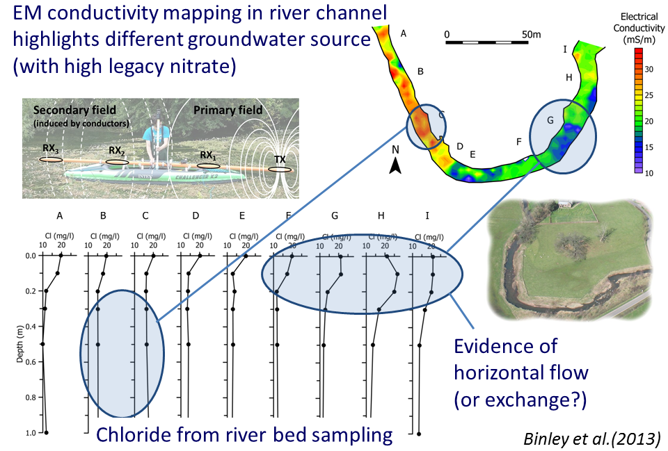
Vadose zone flow and transport processes.
For example, can we predict the movement of solutes through the unsaturated zone?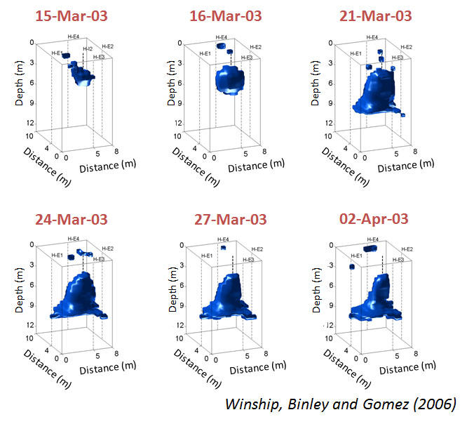
Plant soil water interactions.
For example, how do plant roots affect the hydraulic properties of soils?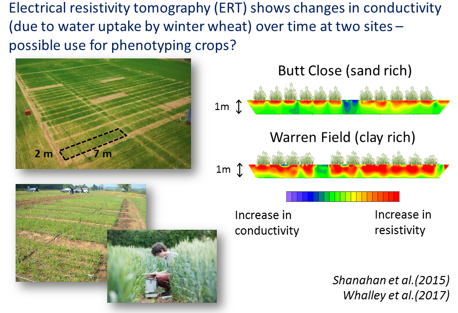
Characterisation of karst
For example, how can we utilise geophysical methods to better understand karstic groundwater systems?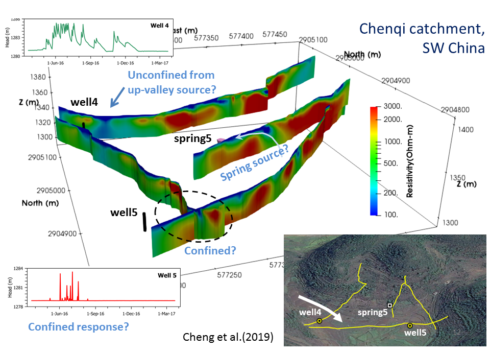
Maximising information in hydrogeophysical surveys.
For example, how do we quantify the information content in geophysics?
Uncertainty in hydrogeophysics
For example, how can we quantify the uncertainty in geophysical images and how this uncertainty translates to hydrological information ?
(gif produced by Michael Tso, Lancaster University)
Hydrogeophysical data fusion.
For example, how can we incorporate knowledge of hydrological processes to constrain our geophysical inversions?
(gif produced by Michael Tso, Lancaster University)
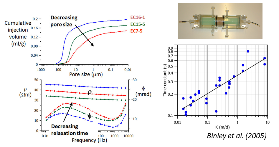
Electrical spectroscopy of porous media.
For example, how can we use electrical spectra to infer hydraulic properties and processes?