NERC Project GR3/9439
Upscaling water and sediment flows in disturbed rainforest mosaics to the lumped catchment unit
Dr Nick Chappell (Lancaster University), Prof Ian Douglas (University of Manchester), Dr Rory Walsh (University of Wales)
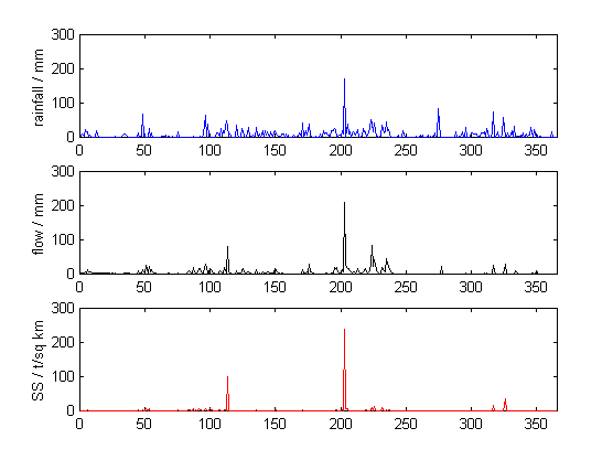
This study has attempted to describe and parameterise (model) the water and sediment flows at the grid- to catchment- scales. As the process descriptions are usually made at the point-scale of perhaps less than 1 sq m, identifying relationships between this integration unit and the grid and catchment units was also an objective. Numerous authors identify greater understanding of the relationship between point-, model grid- and catchment- scales as key to improvements in the modelling of hydrological, erosional and climatic systems. Such developments would facilitate more robust model parameterisations, or the ability to estimate the behaviour of 'similar' catchments following limited measurement or with different feature distributions (e.g., primary sediment sources). In this study the multi-scale data were collected from a rainforest terrain adjusting to forestry disturbance that occurred 5 years prior to the start of measurements. Identification of persistent sources of river suspended sediments in terrain expected to be recovering from forestry operations was, therefore, the applied aim of the work. Indeed studies that describe the dominant hydrological-erosional processes operating at catchment-scales are increasingly demanded by those defining and assessing the criteria for sustainable forestry
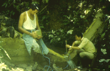
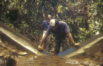
Station 1
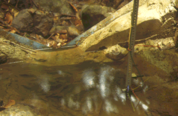
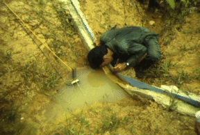
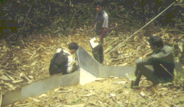
A 120 degree V-notch weir gauging the 0.441 square km 'Baru experimental catchment' near to the Danum Valley Field Centre, Sabah, Malaysian Borneo
Kawi Bidin, Paun Kukuon, Jonny Larenus and Jamil Mohd Hanapi (DVFC)
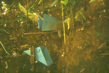
Station 2-East
A 120 degree V-notch weir gauging 0.046 square km, a region experiencing landslides on 4-Dec96 and 19-Jan96. (The region covers 10.4 per cent of the Baru catchment)
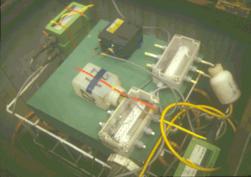
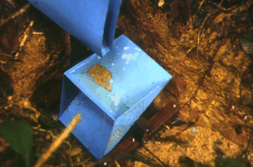
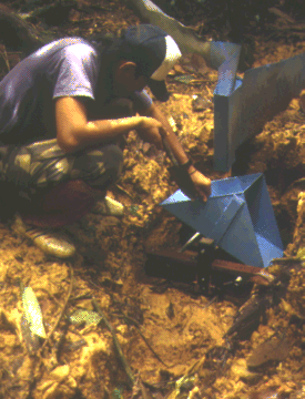
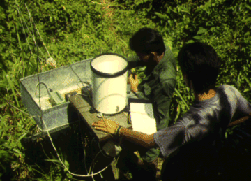
Datalogging systems for waterlevel and turbidity, plus an automatic-liquid-sampler for turbidity to suspended sediment calibration
The '4-Dec94 road-landslide' within site 2-East
Station 2-Middle
A 120 degree V-notch weir gauging 0.143 square km and containing river sediments sourced by collapse of two road-culverts on 19-Jan96. (The region covers 32.4 per cent of the Baru catchment)
Station 2-West
A 120 degree V-notch weir gauging 0.190 square km region containing a high degree of canopy disturbance and the Station 4 road-gully, but relatively modest suspended sediment loads. (The region covers 43.1 per cent of the Baru catchment)
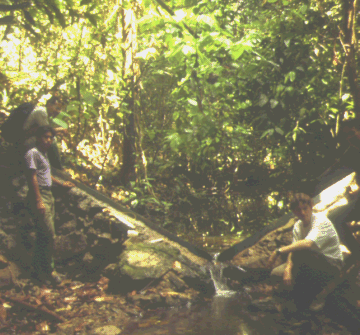
Station 3
A 120 degree V-notch weir gauging 0.0012 square km, and partly fed by a large soil pipe
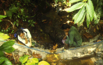
Station 3TB
The tipping-bucket mechanism gauging 0.0006 square km of undisturbed planar slope
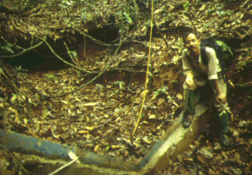
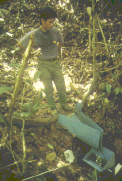
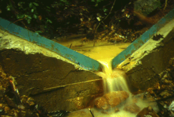
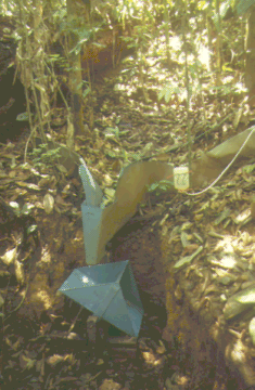
Station 4
A 120 degree V-notch weir gauging a 0.013 square km region draining via a major road-gully
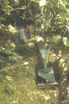
Station 4TA
The zinc approach flume to the tipping-bucket gauging a 0.00155 square km region comprising mostly of a relatively un-compacted skid trail
Station 4TB
The tipping-bucket mechanism gauging a 0.0015 square km channel head region
Station 5
A 120 degree V-notch weir gauging a 0.0075 square km region of relatively undisturbed forest and terrain
Station 5TA
The tipping-bucket mechanism gauging a 0.00145 square km channel head region
Station 5TB
The tipping-bucket mechanism gauging a 0.00140 square km channel head region
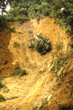
Station 6
A 120 degree V-notch weir gauging a 0.033 km region one day before being destroyed by the road-landslide of 4-Dec94 (see photo above)
Station 6TA
The tipping-bucket mechanism gauging a 0.0003 square km region of haul road and associated road-side drain (destroyed by a landslide on 19-Jan96)
Station 6TB
The tipping-bucket mechanism gauging a 0.0017 square km region of undisturbed forest above the haul road and road-landslides of 4-Dec94 and 19-Jan96
Station 1R
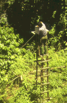
The tower raingauge (tipping-bucket) in a canopy gap near to the station 1 weir
Station 3R
The tower raingauge (tipping-bucket) in a canopy gap near to station 3TB
Station 4R
The raingauge (tipping-bucket) in a large canopy opening near to the station 4 weir
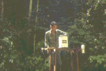
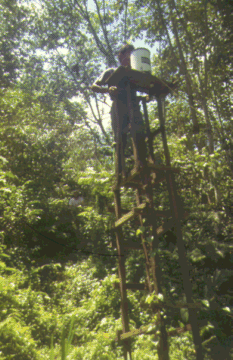
Station 5R
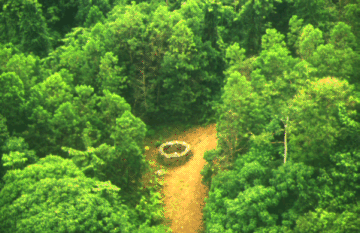
The raingauge (tipping-bucket) on the haul road, seen from the air
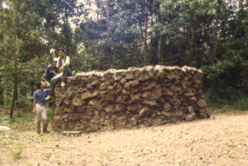
The chert/concrete wall built to protect raingauge 5R from elephant attack (a problem observed at this site from 1992 to 1994)
Station 6R
The tower raingauge (tipping-bucket) in a canopy gap near to stations 6 and 6TA. The tower was destroyed by the 19-Jan96 landslide, so the raingauge was relocated on the haul road (making it at risk from elephant attack)
Further information and the data for these experimental stations (1 July 1995 to 30 June 1996 and other) can be obtained from:
Department of Environmental Science
Institute of Environmental and Natural Sciences
LANCASTER UNIVERSITY
Lancaster LA1 4YQ,
United Kingdom
Tel: (+44)-1524-593933 Fax: (+44)-1524-593985
Copyright © Dr. Nick Chappell, Lancaster Univsersity 1998. ALL RIGHTS RESERVED.